
CERC — Environmental Software and Services
- Overview
- Air pollution modelling
- ADMS 6
- ADMS-Roads (Extra)
- ADMS-Urban
- MAQS
- ADMS-Airport
- ADMS-Screen
- Feature comparison
- Emissions management
- EMIT
- Wind energy and airflow
- FLOWSTAR-Energy
- Accidental releases
- GASTAR
- LSMS
- ADMS-Puff
- ADMS-STAR
- Managing model runs
- Run Manager
- Model evaluation
- Model Evaluation Toolkit
- Meteorological data processing
- WRFtoMet
- Related Documentation
- User guides
- Technical specifications
- Model validation
- Newsletters
- Publications
- CERC co-author publications
- CERC software publications
- Presentations
- Other information
- Traffic emissions
- Prices
- Free demo
- Visualisation tools
- Current software versions
- System requirements


ADMS-Urban
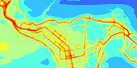
World leading software for urban air quality management
Model options
Advanced options include:
- Urban chemistry
- Fast reactions for NOx, O3, SO2
- Features affecting urban flow and dispersion
- Street canyon, tunnel and elevated roads modules
- Allowance for the effects of complex terrain and changes in surface roughness
- Allowance for the effects of the urban canopy
- Allowance for the effects of buildings local to sources
- Allowance for the effects of noise barriers
These flow modules are based on the latest understanding of the way these features affect the movement of airflow and turbulence around the sources; all have considerable effect on observed concentrations.
Chemistry module
In many urban areas, the dominant pollution source is road traffic, and the pollutants usually of interest are NO2, NOx, O3, PM10 and PM2.5.
ADMS-Urban models NOx chemistry using the 8-reaction Generic Reaction Set (Venkatram et al., 1994) that includes reactions with ozone and VOCs. The NOx chemical reactions take place over a relatively short time period and in order to calculate NO2 concentrations, NOx chemistry needs to be taken into account. The Generic Reaction Set also predicts changes in ozone concentrations.
ADMS-Urban also includes a SO2 chemistry module using a reaction set based on those used in the EMEP model (Tsyro, 2001). These reactions generate significant concentrations of particulates in areas where there are a large number of industrial sources emitting SO2 or downwind of a large emitter of SO2.
Regional Chemistry
Background concentrations for the air approaching the main modelling domain may be considered using a regional air quality model automatically coupled to ADMS-Urban model using the Multi-Model Air Quality System (MAQS), or by using ADMS's built in Lagrangian Trajectory Model. This allows for the effects of emissions, chemistry, deposition and ozone entrainment to calculate a spatially varying ambient background concentration.
Street canyons
'Street canyons' are the deep, narrow, valley-like spaces created when a road is enclosed by tall buildings on both sides. Pollution can become trapped in a street canyon, leading to poor air quality.
ADMS-Urban models this effect using an advanced street canyon module, specifically developed by CERC (Hood et al., 2014), which includes the following features:
- Consideration of a wide range of canyon geometries, including the effects of tall canyons and of canyon asymmetry;
- Modelling of the spatial variation of concentration within the canyon;
- The ability to restrict emissions to a subset of the canyon width so that they are specified only on road carriageway lanes and not on pedestrian areas;
- The option to include consideration of 'network' effects, where pollutants reaching the end of one street canyon can pass into a connected canyon; and
- Calculation of the effects on concentrations both inside and outside the street canyon.
The Mapper's 'Canyon and canopy' tool can be used to generate the additional input data required by the module from road network geometry and 3D buildings data.
ADMS-Urban also includes a simpler street canyon module based on the Danish Operational Street Pollution Model (OSPM).
Complex terrain
This module is based on FLOWSTAR advanced airflow model which calculates the change in mean flow and turbulence due to terrain and changes in surface roughness (land use).
Urban canopy
The urban canopy module calculates a neighbourhood scale variation of wind speed and turbulence based on gridded values of building height, horizontal and vertical area density. In areas with taller buildings and higher building densities, the near-ground wind speed is reduced and the turbulent intensity is increased. In contrast, areas with lower building heights and densities, such as large urban parks or outlying residential areas, can show increased near-ground wind speed and reduced turbulent intensity. These changes alter the dispersion of pollutants, especially from near-ground sources such as roads.
The additional input data required by the module can be calculated from road network geometry and 3D buildings data using the Mapper's 'Canyon and canopy' tool.
Buildings
Users can include the effect of up to 25 dominant buildings on point source emissions. ADMS-Urban creates an effective building for each point source from the user-defined buildings and models the re-circulating flow in the lee of the building, the cavity region, as well as the building main wake.
Road tunnels
ADMS-Urban can calculate the displacement of road traffic emissions from within a road tunnel to the tunnel end. The model creates volume sources outside the tunnel exit portal, optionally following a connected outflow road, with extents depending on wind speed and traffic speed. ADMS-Urban can also represent artificial tunnel ventilation systems which extract traffic pollutants to a separate vent location.
Elevated roads
The downward dispersal of emissions from roads above ground level (for example bridges and flyovers) will only occur after the material has been advected past the downwind edge of the road. In ADMS-Urban, to account for this, the downward spread of the plume is limited during its traversal over the road surface.
Noise barriers
The presence of a noise barrier at the edge of a road inhibits the dispersion of emissions from traffic on the road, reducing near-field ground level concentrations downwind of the barrier. In ADMS-Urban this effect is represented by modelling the road as an elevated source.