
CERC — Environmental Software and Services
- Overview
- Climate change adaptation and Net Zero
- Industrial permitting and planning
- Low Emission Zones and Low Traffic Neighbourhoods
- Air Quality Management
- Planning and development control
- Hazardous releases
- Odours
- Wind energy and airflow
- Climate change adaptation and urban environment
- Emissions inventories and emissions verification/ optimisation
- Model evaluation
- Aviation and air quality
- Assessment of impacts on sensitive habitats
Climate change adaptation and urban environment
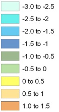
Temperature variations relative to ambient (°C)
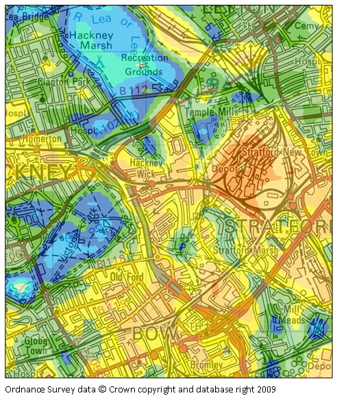
Local temperature variations on a late summer afternoon
We apply our ADMS Temperature and Humidity model to investigate how land use, buildings and anthropogenic activities affect local climate and urban heat islands. This can answer such policy and planning questions as:
- How does the conversion of this green space into housing (or vice versa) impact on the local climate?
- What is the impact of widespread use of air conditioning and/or tree planting on the local climate?
- How effective are green and cool roofs on reducing local temperatures?
- What impact does building fabric and reflectivity have on the local climate?
CERC's expertise in this field has led to a number of collaborations where the ADMS Temperature and Humidity model has been used to develop urban heat island maps of cities including Beijing (China), Kuala Lumpur (Malaysia), parts of London (UK), and Birmingham (UK). In an ongoing NERC-funded project, the University of Birmingham are generating urban heat island maps for use within a Climate Risk and Vulnerability Assessment (CRVA) tool.