
CERC — Environmental Software and Services

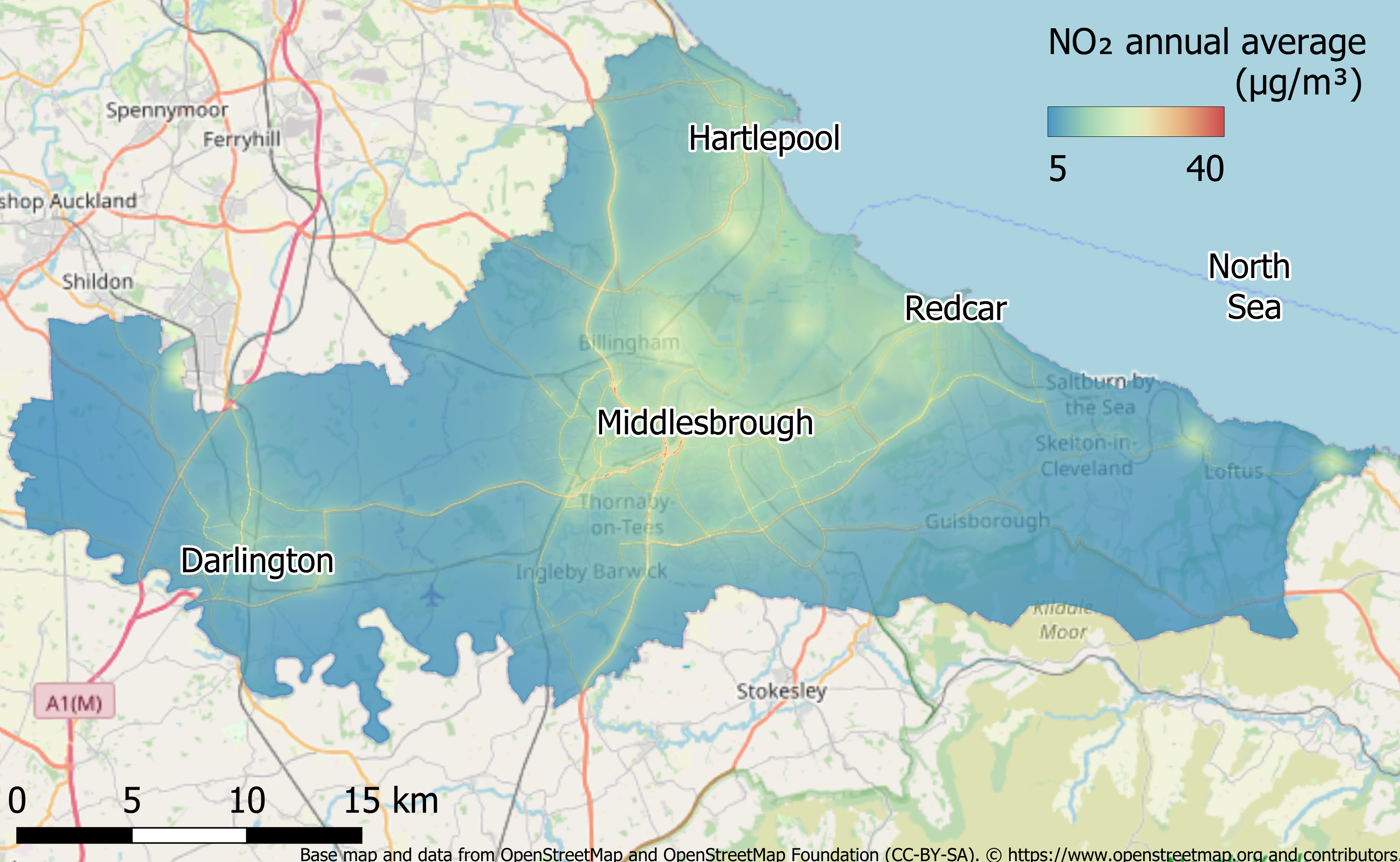
Near Real Time modelling of the Tees Valley, UK
The APACE Net Zero project sought to use advanced techonology to monitor, report and validate the emissions from industrial and consumer activity in the Tees Valley region. The aim of the project was to develop a detailed approach to identifying sources and concentrations of air pollutants including
CO2, NOx, SOx and particulates, to facilitate decarbonisation initiatives and aid compliance with environmental directives.
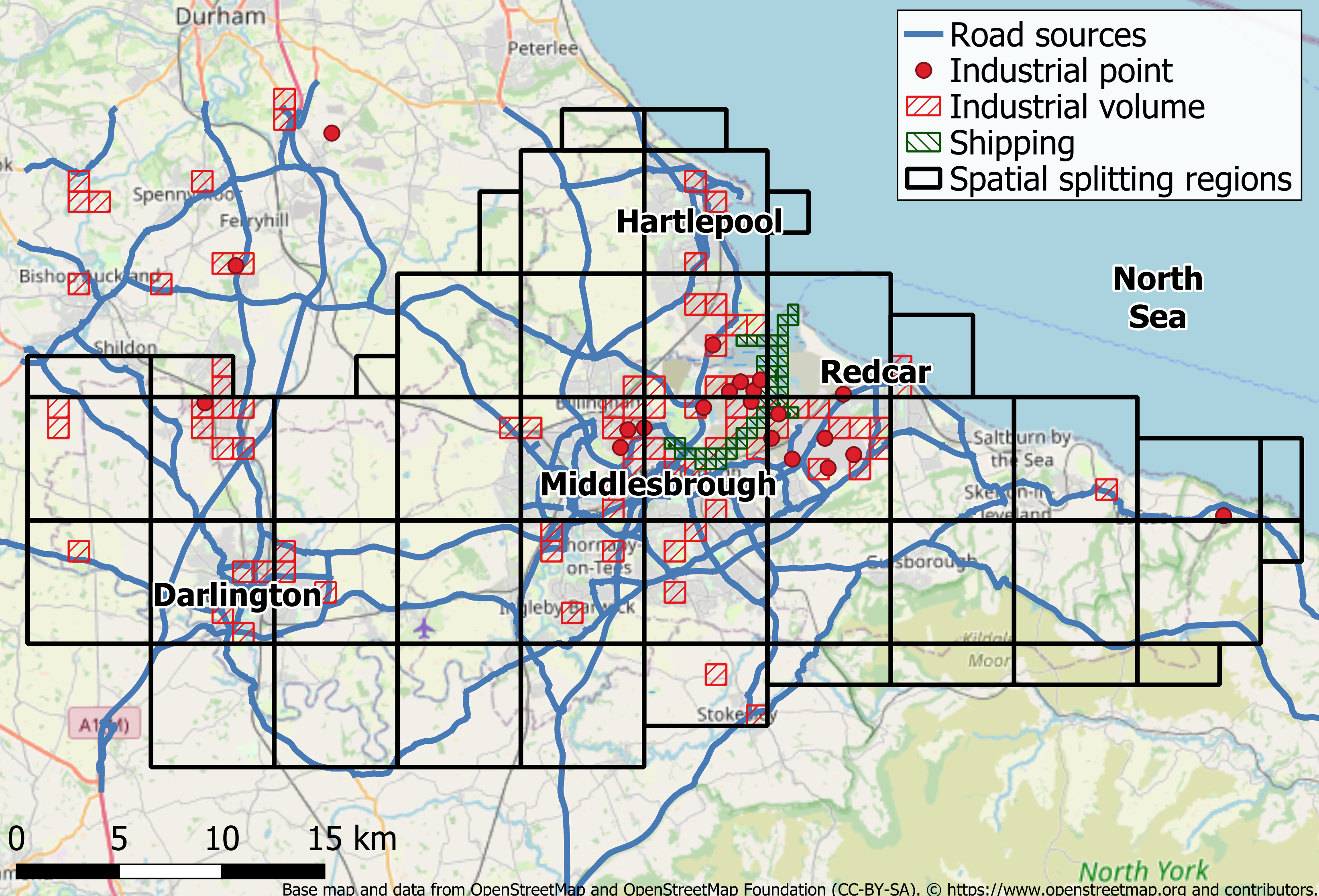
CERC's role in the project was to carry out air quality modelling across Tees Valley, based on Department for Transport and National Highways traffic data, National Atmospheric Emissions Inventory (NAEI) data and detailed shipping emissions, based on Automatic Identification System (AIS) activity data. The model was used as the basis for a Near Real Time (NRT) modelling system, with a live feed of shipping data provided by Redshift Associates Limited.
The project was led by BP International, and CERC was subcontracted to work on the project by Satellite Applications Catapult Services Limited alongside Geospatial Insight.